Sam Johnson and I just got back from 16 days in the Eastern Alaska Range, enjoying mostly warm, sunny conditions that allowed us to climb two new routes: The Direct West Face of Mount Hayes (V, AI3 R, 6500')...

(Photos and annotations above and below by Sam Johnson)
...and the North East Buttress of Mount Balchen (V, M6, AI4, 3500'):

We first flew in to the Gillam Glacier in late April, and after several days of double carrying large loads, stood at the base of both Mt. Hess and Mt. Deborah. Conditions were quite warm on both objectives, and we realized we were a few weeks late since the 'ice feature' we had been looking to climb on Hess was a waterfall visible from over a mile away up to about 11,000'! It turned out that Fairbanks was setting record high temperatures in the 80s during this time. We called Rob Wing of
Wing's Air Service and got transported over to the Hayes Glacier. Below is Sam mourning the conditions and rock quality at the base of Mt. Deborah.

Rivers would appear on the glacier over the course of hours, forcing us to walk and ski through copious slush and water...which turned out to be a significant obstacle to traveling. In the background you can see a classic afternoon thunderstorm, which became a recurring part of our trip.

Rob Wing's excellent flying skills saved us at least a day of heavy load hauling since he was able to land us on the bare glacier ice high on the Hayes Glacier. In my non-pilot mind it was a gutsy place to land, but he nailed it perfectly 3 times in a row. The tundra tires seemed to handle the slush filled holes with ease...

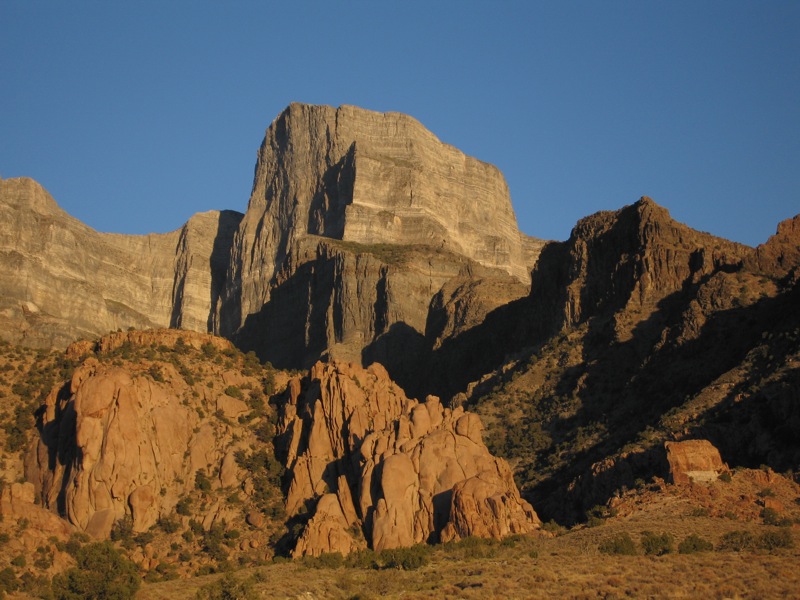
Rob and his plane, below Mt. Balchen...

After moving up in to the basin, and spending a day looking through the spotting scope at objectives, we decided to get on the W. Face of Hayes. After crossing the bergschrund we climbed about 3000' of neve up to 55 degrees or so, to the beginning of the ice at about 10,000'.

The route ended up being easier than we thought it would, and we simulclimbed the 3000' of ice up to about 80 degrees. We crossed through a couple bands of rock, though I wouldn't call it mixed climbing. There were some seracs above us, but they were mostly off to the side and didn't threaten our route too much. Sam leading out...

Sam below...

My foot, and Sam on his way up...

Me leading up towards an interesting ice tower, through some terrible black rock. By this time our calves were wishing the snow stuck to the ice was thick enough to avoid front pointing...but sadly it wasn't. Photo by Sam Johnson...

Sam on his way to the summit ridge...

The summit ridge consisted of about 500' of easy neve climbing, depositing us on the summit. It was an awesome view, as we were in and out of the swirling clouds. We could smell smoke from forest fires (95 of them were burning in the state at the time) and the sun was very orange making for some spectacular ambiance. We descended a slightly different route, to avoid rappelling under any seracs, doing 16 or so rappels and 3500' of down climbing. We spent a total of 21 hours on the route and descent, including a 1 hour break on the way down to melt some snow.

Me on the first rappel with a smoky sky. Photo by Sam Johnson

Our 25 hour (camp to camp) day took it out of us, so we decided to take 3 days of rest to be ready for the next big effort on Balchen. More and more moisture was building every day, and on our climb day it was pouring rain when the alarm went off at 0300. We took another day off, then launched the following morning under partly cloudy skies. Below is Sam leading the first real pitch, 70 degree alpine ice with a bit of snow somehow sticking to it.

Below is me leading through the mixed crux...clouds building...

And me leading up more ice as the storm sets in...

We had been hearing thunder in the distance all day, a not uncommon occurrence on our trip, as every day thunderstorms would build over the flat lands to the north of us. It started snowing heavily, 2-3 inches per hour as we finished the route and began the snow climbing to the summit. As we neared the top, a loud thunder clap much closer than the previous ones occured, and all of our metal objects began aggressively buzzing and hissing. Despite being so close to the top, we decided to begin the descent. We began to take more notice of the 6 inches of new snow that had fallen in the past couple hours, as aggressive spindrift avalanches pounded us during the 14 rappels. After some concerning isothermic downclimbing, we made it back to the skis 17 hours after leaving them. The heavy snow and zero visibility made the crevasse maze difficult to negotiate during the ski back to camp, but we made it back in the wee hours, 22 hours after leaving camp. The whole next day it poured rain as we ate, slept and rested. Finally, it cleared the following morning as we packed up to hike to a gravel air strip 6 miles away.

The trip ended as it began...with 100lb loads...

 Jim on a ledge, 1 pitch below the top:
 Above is the view topping out...the West Desert is a very satisfying place for a displaced Alaskan looking for some wilderness.
 Above: Jim sending on pitch 11...below on pitch 5.
 The weekend before that, Sally and I hiked Kings Peak, the highest mountain in Utah at 13,528'. It was a great day out, and we did the 25 mile, 4000' route in about 9 hours car-car with no running involved. We thought about running, but just ended up enjoying chatting and hiking...not needing to hurry with such nice weather. Below are some photos of Sal up high. Despite the looks of it, there was a nice trail most of the way.
 The Henry's Fork tail (our route) comes from the trees in the upper left part of this photo...12 miles distant.


 We skied off the summit below in the upper King's River drainage, then lapped it a few more times off the rocky face to the left via a hidden couloir...


